
Download the white paper and get INSPIRED
Learn how collaborative parametric design models allow you to work together for better solutions.
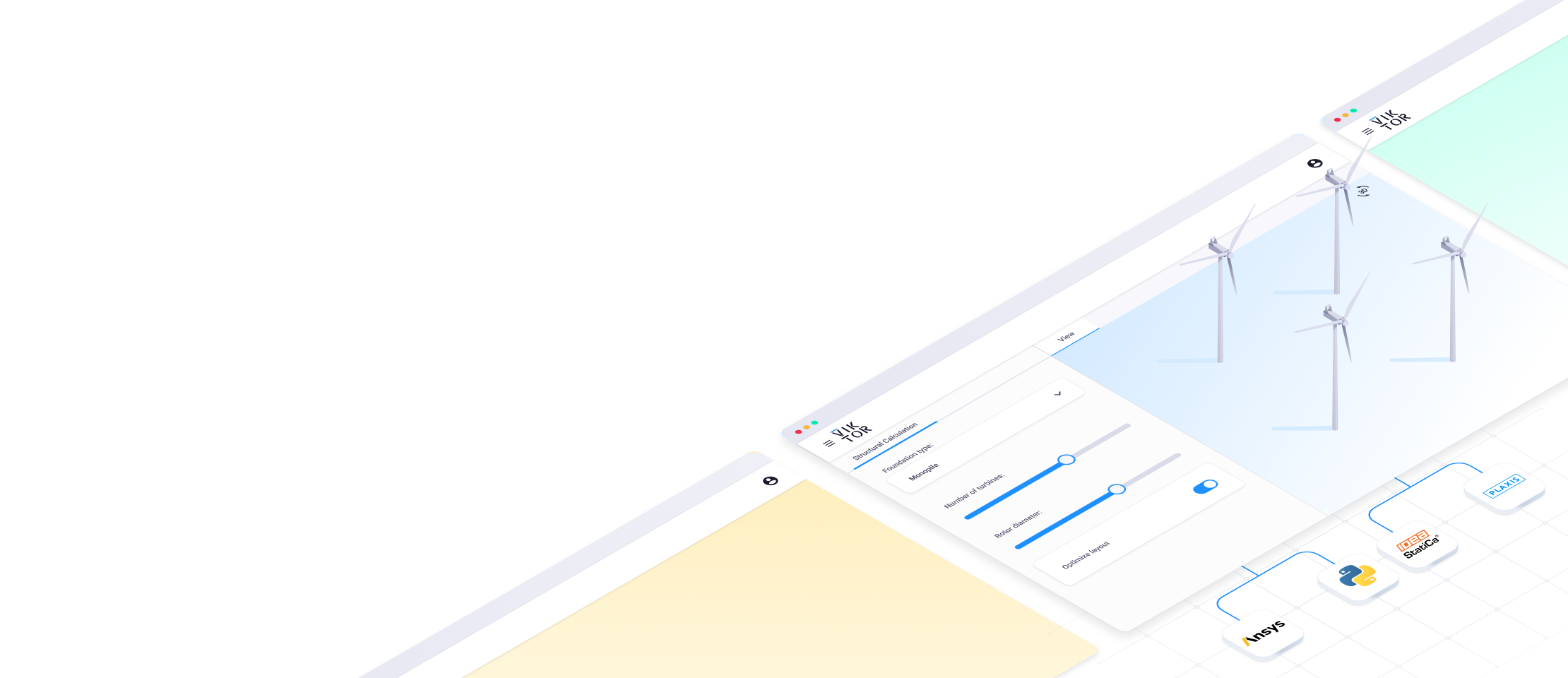
Select 'fullscreen' in the downright corner for a better view of the application.
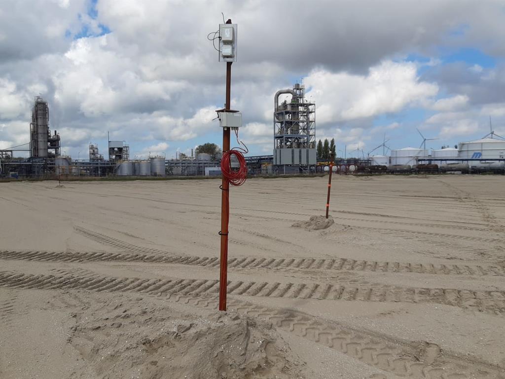
Automatic Ground Settlement Monitoring registration and validation in the Cloud
With Geonius' Ground Settlement Monitoring application, you can easily solve these difficulties and save time registering and interpreting data. The application offers central registration and storage and easy sharing of data (for all of a client’s projects). Additionally, the app has several validation methods that can be used to see if a settlement monitoring device is disturbed, and if so, even automatically compensates for the skew.
Centralized registration
With the Ground Settlement Monitoring application, all monitoring locations and measurement data are centrally registered to provide the correct real-time information to anyone who needs it (for example, to prove the achieved end-settlement). With the app, users can easily access data both online through the browser, as well as through PDF reports. The application provides a map with an overview of all the ground settlement monitoring equipment. All data can be sent to the system at the push of a button, where the validation automatically takes place and potential new monitoring instruments are also automatically created. Additionally, a PDF report of all monitoring instruments can be made to view the history of all monitoring data in a dossier.
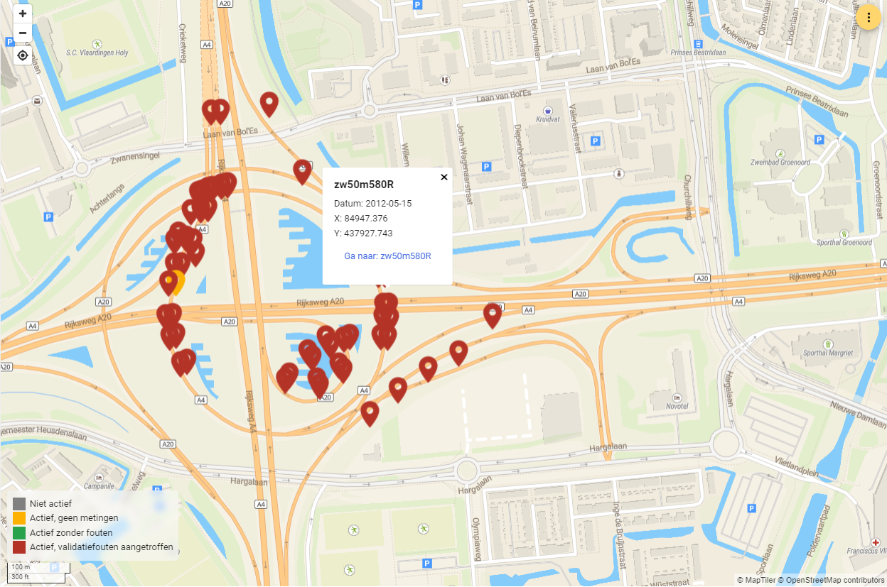
Overview of all monitoring location on the map
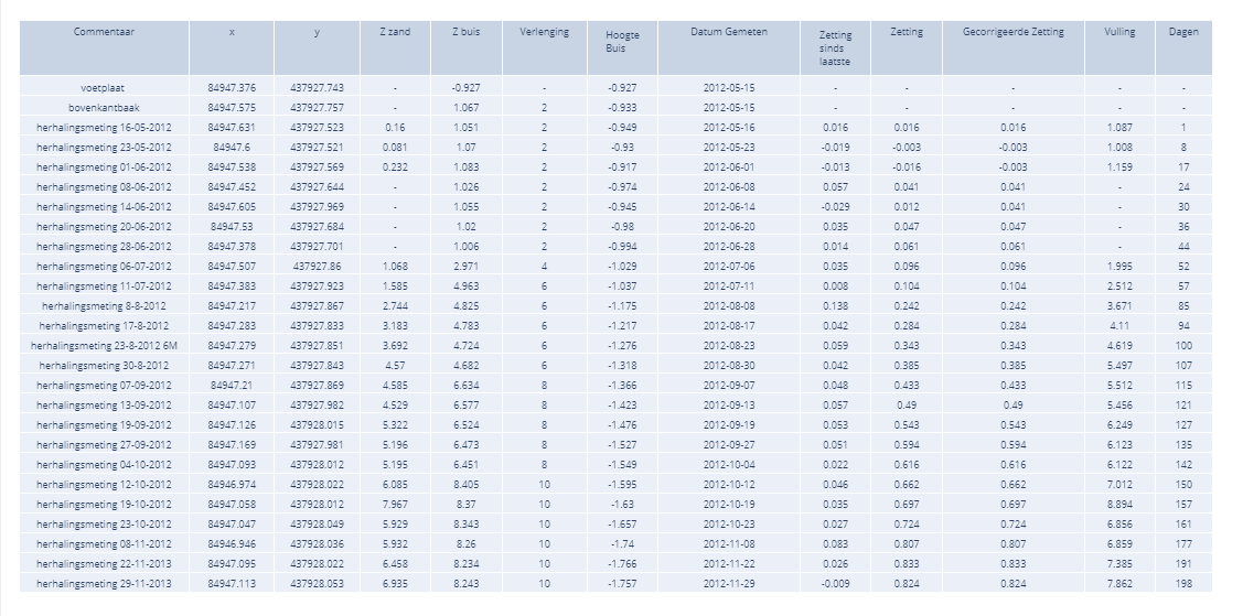
Overview of all settlement measurements
Automatic validation
Measurements are validated within the application to automatically recognize errors, such as a ground settlement monitoring instrument that has been run over, or rising ground level profiles. Users can determine the threshold for the validation themselves. Results of the validation can be viewed in both an overview list and on the map.
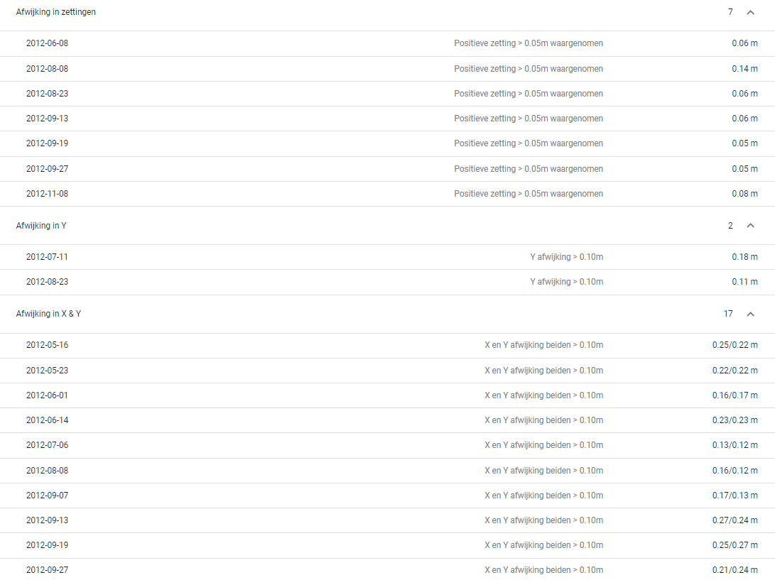
Overview of the measurement validation results
Report functionality
The application has a built-in report functionality that automatically creates graphs per ground settlement monitoring instrument. The graphs are interactive, meaning users can zoom in and out to view the behavior of the monitoring instruments in detail. Additionally, users can determine the start date of the graphs themselves.
All graphs and tables can be accessed through the browser and exported to PDF to be used in reports and presentations – both per monitoring instruments and for entire projects.
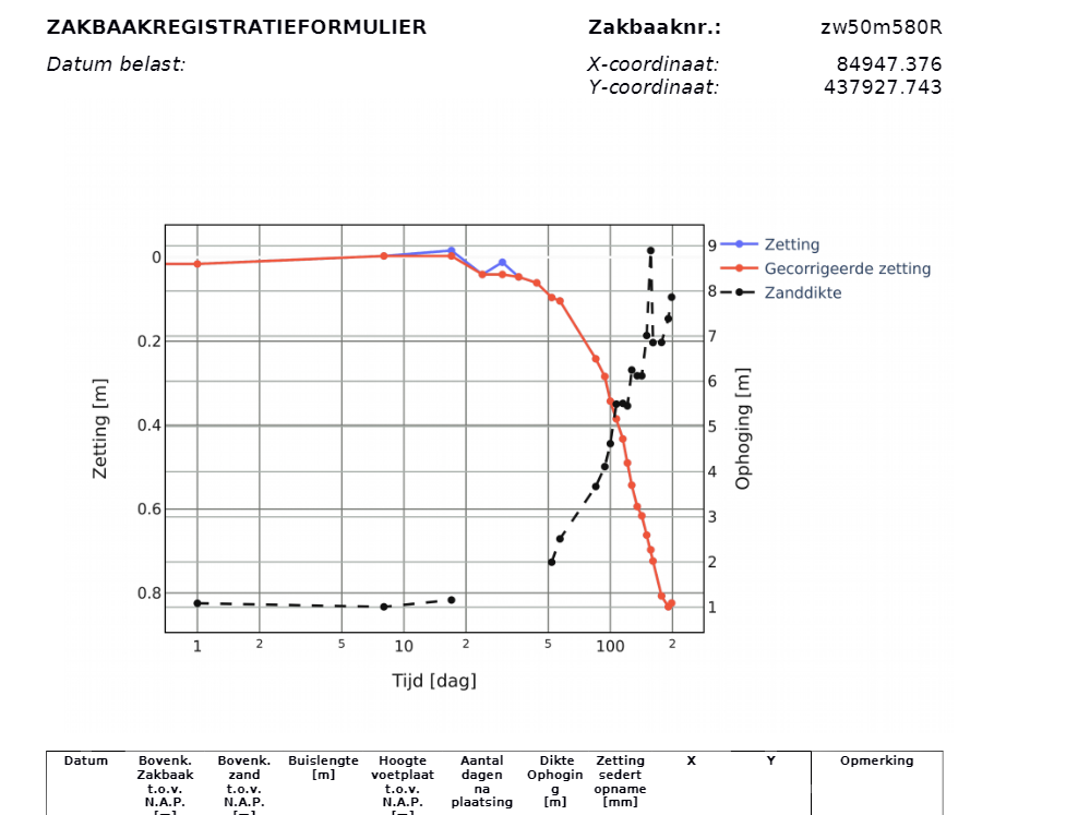
PDF report of results
Subscription
Interested in the application? Use this form to sign up for a subscription.
Currently, we offer two subscription types:
- Regular (via Geonius): €150 per month
- VIKTOR customers (via the App Store): €75 per month
If you want to know more about the application or have any other questions, contact Jordy Brouwers (j.brouwers@geonius.nl) or Quinten van Moerbeke (q.vanmoerbeke@geonius.nl).