Apps gallery
Welcome to the Apps Gallery. Here you can explore, try, and share ready-to-use app templates and their accompanying source code. Discover what you can do with VIKTOR and use it as inspiration to build your own apps!
 by
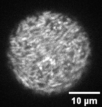
byParticle Image Velocimetry (PIV)
Apply particle image velocimetry (PIV) to analyse the movement of bacteria in a droplet.
 by
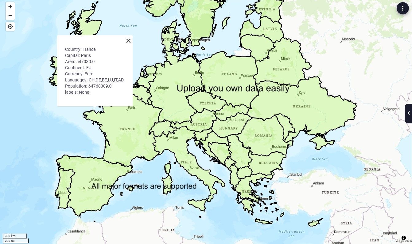
byGeographic Information System
GIS-analysis in VIKTOR with Geopandas open-source library
 by
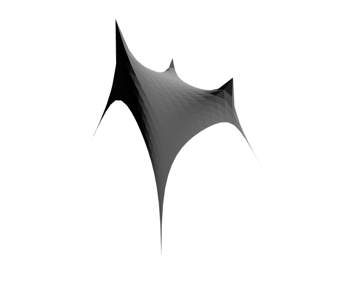
byForm Finding
A simple Form Finding experiment created by using the Grasshopper kangaroo Plugin.
 by
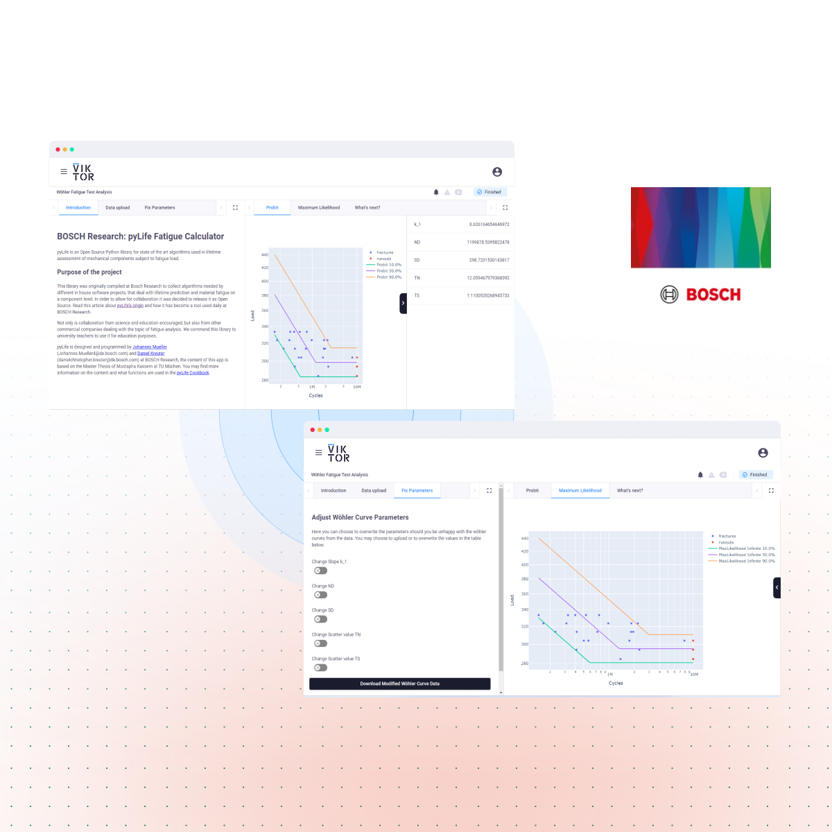
byFatigue Calculator
Open Source Python library for algorithms used in lifetime assessment of mechanical components subject to fatigue load.
 by
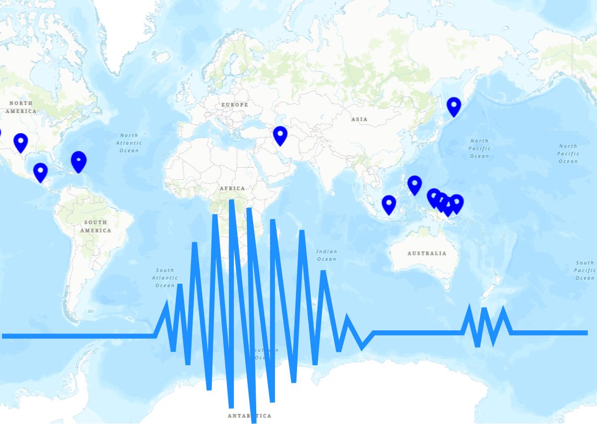
byEarthquakes Data
Track earthquakes, convert strong ground motions to Response Spectra, and draw and download Elastic and Design spectra.
 by
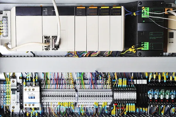
byControl Systems Application
Define your plant transfer function, tune PID, see system response, gain margin, phase margin & delay margin of close loop systems
 by
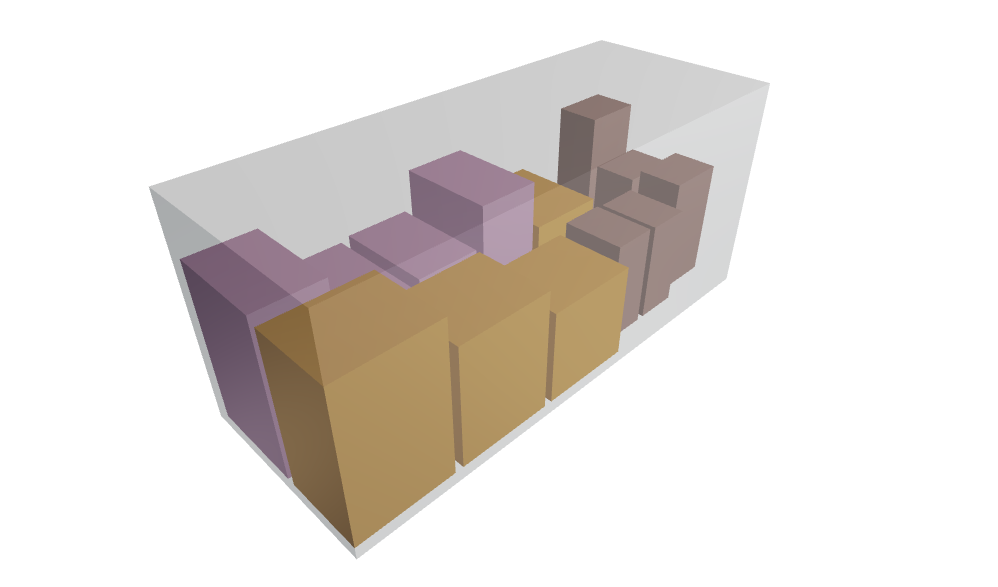
byContainers Loading Optimization
Find the right strategy to load a maximum number of pallets in a sea container
 by
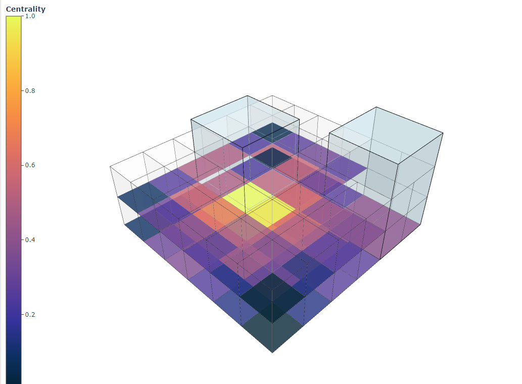
byCentrality analysis
Move two atrium towers within a building and compute the closeness centrality of every space in that building.
 by
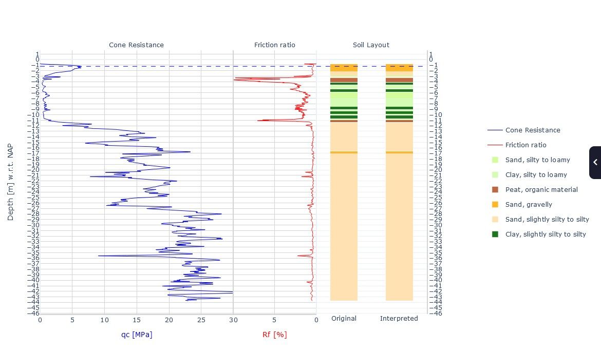
byCPT-interpreter
Interpret a CPT (.gef) file to a soil layout using a classification method of choice.
Apps gallery
Welcome to the Apps Gallery. Here you can explore, try, and share ready-to-use app templates and their accompanying source code. Discover what you can do with VIKTOR and use it as inspiration to build your own apps!
Particle Image Velocimetry (PIV)
Apply particle image velocimetry (PIV) to analyse the movement of bacteria in a droplet.
Geographic Information System
GIS-analysis in VIKTOR with Geopandas open-source library
Form Finding
A simple Form Finding experiment created by using the Grasshopper kangaroo Plugin.
Fatigue Calculator
Open Source Python library for algorithms used in lifetime assessment of mechanical components subject to fatigue load.
Earthquakes Data
Track earthquakes, convert strong ground motions to Response Spectra, and draw and download Elastic and Design spectra.
Control Systems Application
Define your plant transfer function, tune PID, see system response, gain margin, phase margin & delay margin of close loop systems
Containers Loading Optimization
Find the right strategy to load a maximum number of pallets in a sea container
Centrality analysis
Move two atrium towers within a building and compute the closeness centrality of every space in that building.
CPT-interpreter
Interpret a CPT (.gef) file to a soil layout using a classification method of choice.