Download the White Paper and get INSPIRED
Learn about trends in digital transformation and how they affect the engineering and construction industry.
In this blog post, we will talk about:
- The digital transformation in engineering and construction, specifically geotechnics
- The effects of automation, integration, and collaboration within the industry
- The solution to digitally tranformating geotechnical engineering: GeoTools
- The benefits of GeoTools
- How you can help imrove GeoTools
- How you can use GeoTools within your organization
Digital tranformation in geotechnics
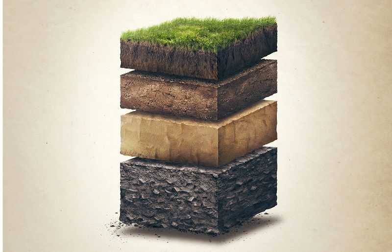
Geotechnical engineering isn’t just another sector that is ripe for a digital transformation. It now just so happens that building is done in and on the ground, and geotechnics is the starting point. Because the soil is never the same in the Netherlands, every building requires a unique solution. Every project starts with a blank sheet on which the substrate must first be properly mapped. That sounds easy. Nevertheless, it is difficult to analyse the entire subsurface on a construction project on the basis of a number of drillings and CPTs (Cone Penetration Tests) and to make a responsible prediction of the foundation. This requires a lot of expertise and complex calculations. Partly because of this, the geotechnical aspects in projects are often a risk. The fact that more information about the subsurface often only becomes available later in the project further increases this risk.
Automating processes
A toolbox with Python digital building blocks that offers usable solutions is already providing geotechnical engineering with the answer to many digital challenges. Although the data that geotechnical consultants work with is always different, the process is the same every time. That is why the activities in this field of expertise lend themselves well to the automation and digitisation of process steps. Of course, a frequently heard counter-argument is that geotechnical consultancy is work that can only really be done by a person with a lot of knowledge and experience. Yet a mindshift is visible. And there is a reason for that.
Combining forces
Consultants do a lot of repetitive work, while a computer with an algorithm performs complex calculations quickly and more reliably. During the construction of a tunnel, the base can vary every 100 meters and mapping it adequately requires a chain of new calculations. These analyses are complicated and very labour-intensive. Because of this distance between the measurements on a construction site, its tedious, and sometimes impossible to get a good insight. Even if the analyses and soil map are correct, design changes, optimisations or unexpected influences often surface during a project that require new calculations. There is often no time for these changes later in the design or construction process. If it is possible to map out this new situation quickly and integrate it with the existing data, the quality of the advice will improve considerably and the risks will decrease.
Download the White Paper and get INSPIRED
Learn how you can boost digital transformation in your organization by focussing on people, rather than technology.
Automation, integration, and collaboration
By automating the geotechnical process on the basis of existing domain knowledge, humans and computers can reinforce one another. By integrating previously disconnected disciplines and jointly developing applications for digitization of processes, an increase in speed and efficiency and decrease error margins and failure cost in the sector can be achieved.
Automating processes
Automating process steps offers the opportunity to process and analyse more data in a shorter time. This contributes to better interpretations of data and decision-making for the individual process steps, and for the whole. In practice, insights and advice are obtained by combining different partial solutions within a multidisciplinary team.
A change in one domain in turn triggers a chain of changes in other disciplines. The challenge is therefore not only to automate these (digital) islands, but also to connect and integrate them.
"The work of engineers is heading towards cloud computing, machine learning and artificial intelligence. There is no doubt about that and it would be foolish to ignore this. The VIKTOR platform is an indicator of what our computing tools will look like in the near future.”
Integrating disciplines
Digitisation is less effective if all partners in this chain of disciplines pick up and implement this process independently. This applies to consultants, designers and construction companies. Although construction companies compete, the process steps for projects are largely generic. By jointly developing applications for the digitisation of the design and construction process, speed and efficiency in the sector will increase. At the same time, the error margins and failure costs decrease.
Joint development
This realisation has now reached the construction world. BAM Infra Nederland, Ballast Nedam and Heijmans already jointly developed an application for automating the design process of soil bodies. The application, which is based on the VIKTOR platform, links various data sources and software packages together. In addition, they use it to generate more design solutions at a quicker pace.
Although the construction companies are competitors, they nevertheless work together because the distinctive character of the developed application is limited in itself. It is about how the individual companies integrate this application in their own process. They are therefore not afraid of competition, but see the added value of combining knowledge and investments.
Rob van Putten, from Waternet, thinks government agencies should adopt this model too:
“Water boards – that have the task of testing all flood defences geotechnically – could develop modules in collaborative ventures and make them accessible via VIKTOR. In this way we can prevent the wheel from being re-invented over and over, and we can work much more efficiently."
Build any application you can imagine
GeoTools explained
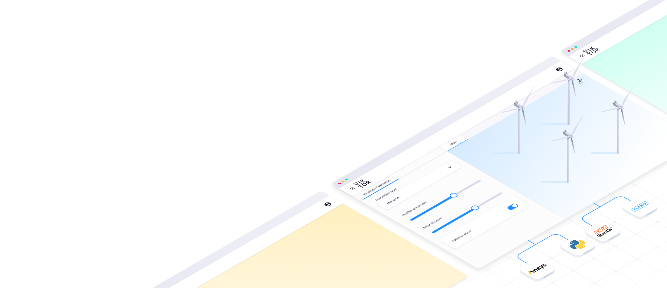
VIKTOR believes in the power of digitisation together. That is why we invests in the development of a toolbox for geotechnical engineering: GeoTools. GeoTools uses building blocks to facilitate work-efficiency, for example by enabling automatic interpretation of CPTs and drilling.
Geotechnical engineering
If you are a geotechnical engineer or working with geotechnicians, you will recognise how slow and tedious it can be to interpret CPTs, create a 2D soil layout and set up your model with all soil properties. This is especially the case for larger projects with 10 or more CPTs. When working on large infrastructure projects, such as dikes, highways, or tunnels, creating these models can become your daily job. In this article you can read more about how this can be done more easily with GeoTools but first, let us show and explain what the GeoTools are.
Digital building blocks
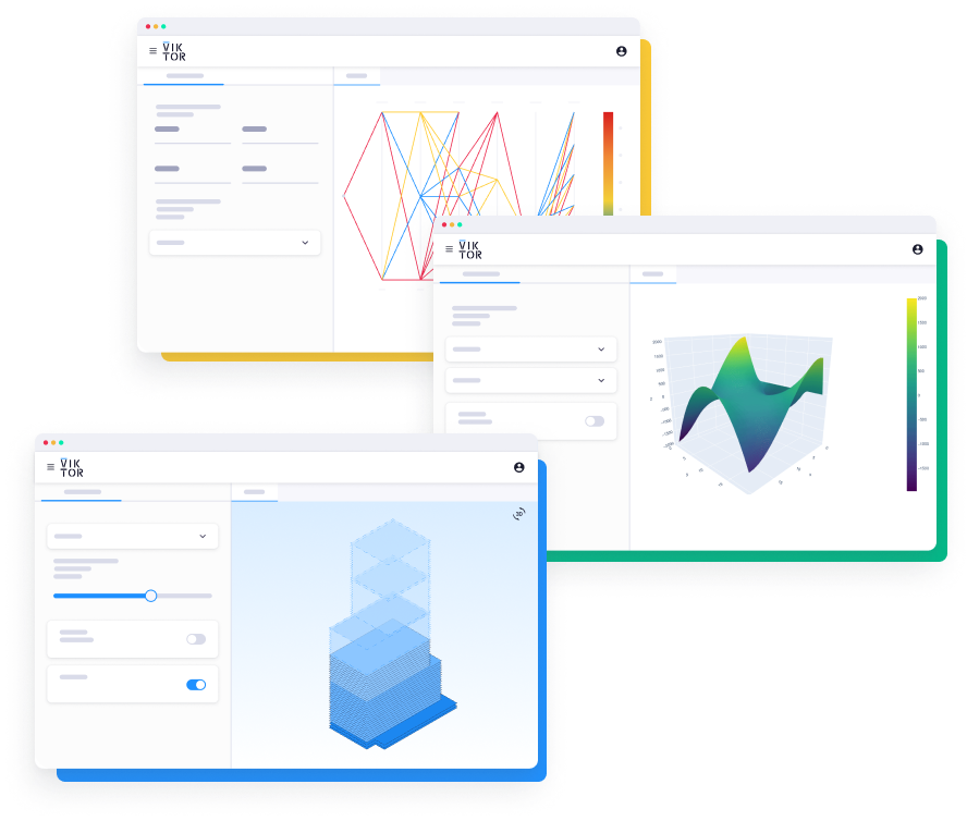
The GeoTools toolbox consists of Python building blocks that individually or in combination provide full functionality to allow the geo-technician to work more efficiently. These blocks, together with all multidisciplinary building blocks, form the puzzle pieces of the total design of, for example, an infrastructural project.
Quality-guarantee
In order to guarantee a toolbox with building blocks of the highest value, the platform for the development of the blocks works together with geotechnical consultancy CRUX Engineering and knowledge institute Deltares, amongst others. Within this initiative, CRUX’s sister company CEMS (CRUX Engineering MicroServices) realises so-called microservices for specific geotechnical calculations.
"With such standard building blocks, complex projects can be efficiently converted to a good end product." - Ritchie Vink, co-founder at CEMS
CEMS was founded to further develop the skills for software development and artificial intelligence. This sister company develops and supplies microservices or Cloud-based tools that can be part of a design process via an API. Ritchie Vink, co-founder of CEMS: “People are not scalable, so it is easier to automate repetitive calculations. Then people can focus on control and advice. We have specialist knowledge of and software for geotechnical engineering and use it to automate our own processes more efficiently. But we can also help others in the construction chain with that. For example, if we consider an algorithm for a pile calculation that we offer in a subscription form. With such standard building blocks, complex projects can be efficiently converted to a good end product.”
Collaboration
The focus of CEMS is on microservices and data analytics, and the company does not want to be bothered with the user experience or front-end. Vink: “That’s where VIKTOR comes in. They make our microservices accessible to others via GeoTools. We use this toolbox to supply standard Python code building blocks with which companies can build their own applications. If other specialists also develop building blocks, they enrich the toolbox and together we build proven standards. We are still at the beginning of this development, but by investing together, we are taking the most important first step.”
Model integrations
For Deltares, which develops calculation models, it is important to be able to link these models more easily and integrate them with other tools. VIKTOR then offers these building blocks integrated and on a pay-per-use basis via the platform. In this way, geotechnical consultants, construction companies or other parties can use or build professional applications more quickly.
Soil layout digitisation
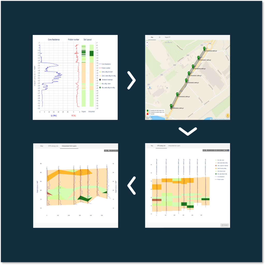
GeoTools is the first geotechnical standard application for automated interpretation of CPTs and drilling. GeoTools helps geo-engineers centralize, interpret, inspect, modify, and use their project’s CPT collection. Whatever a project is about, there are some aspects of working with CPT’s that reccur each time. CPT’s form the basis for many different calculations. They have to be interpreted, that is to say translated into a soil profile. The soil profile can then form the basis for various calculations, e.g. pile foundations calculations, dyke stability calculations, sheet piling calculations and much more.
“A construction project starts with mapping the ground. If you consider a geotechnical consultant’s work process, he receives the data from CPTs and drillings in separate files that sometimes also differ in format. These are often printed for comparison. It requires a lot of manual work to get from the CPT to a soil structure.” - Stijn Jansen, head of application development at VIKTOR
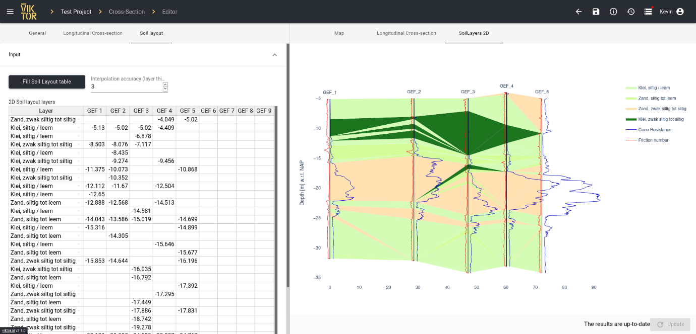
A Soil Layout Table in GeoTools
The toolbox speeds up this process and makes it more accurate and standardised. Stijn Jansen: “The data files of a CPT are loaded into a web application and the soil structure is immediately available visually. The calculations and analyses are automated with algorithms. Subsequently, the consultant quickly has a good idea of the soil structure. And if additional drilling or CPTs follow, this data is integrated and processed in the soil structure. This forms the basis for further calculations, such as, for example, of the pile foundation. This can then be done with other building blocks, such as the microservices from CRUX or the D-series from Deltares.”
Start building apps now
Why GeoTools
There are several benefits to using GeoTools on within your organization, such as the acceleration of repetitive and manual processes to safe time (and money), the development of intellectual property, the channeling and refining of domain knowledge, and the possibility to easily integrate different processes and work from one central database.
Acceleration
Jacco Haasnoot, director at CRUX, explains why his company is participating in this initiative. “VIKTOR is a driver of digitisation in the construction sector. We too must and want to participate in this. We still use (VBA) Excel a lot for our consultancy, but there is clearly a need for further automation of the design process. Our people also spend a lot of time processing data. With an algorithm we can calculate more variants more quickly and monitor the quality better. Process steps are then more transparent and the number of errors decreases due to less manual work.”
“VIKTOR is a driver of digitisation in the construction sector. We must and want to participate in this. - Jacco Haasnoot, director at CRUX
Ready to save time? Learn how GeoTools can speed up your geotechnical design process and make your data insightful here.
Intellectual property
Using GeoTools results a shift in the business model of consultancy and engineering firms. Haasnoot: “Presently we mainly sell the hours we spent to conclude our consultancy to our clients. Our knowledge and experience is recorded in good Excel sheets. These are our crown jewels, which we do not want to give away just like that. By developing microservices, we translate our knowledge into software that others can also use. They enter data and receive output that is paid, which gives them a new revenue model. The intelligence required for this remains our property. We currently have around 30 to 40 Excel sheets that we can potentially offer as a microservice.”
Domain knowledge
Van Putten identifies that digitalisation is creating new business opportunities for small businesses or freelance specialists too. “As a small entrepreneur, VIKTOR offers me a platform to unlock specific domain knowledge via apps to an audience that is difficult to reach without this platform. The development of such a platform would normally take years of development time and is now being taken care of”
Quick integration
The advantage of GeoTools is not only the availability of a wide and complete range of building blocks and solutions. The toolbox also facilitates the integration of different process steps based on the same data, which is shared along the way. All VIKTOR building blocks are web-based and use one database. This gives all disciplines access to the same data. There is always one version of what is considered the truth. Vink: “A microservice for a pile foundation can be built up from our algorithm in combination with structural design software. This however still needs considerable work. We can facilitate this faster with our microservice. And if multiple pile types are required, we can quickly calculate all variations as a basis for multiple scenarios. This directly contributes to a better end result.”
Build any application you can imagine
Using and improving GeoTools
GeoTools is currently up and running. You can now use GeoTools through the VIKTOR demo environment. Some code is already openly available through VIKTOR GitHub repositories, enabling engineers to build on and improve GeoTools together.
Improving GeoTools
Currently, the first versions of GeoTools have been developed and tested. The feedback from geotechnical consultants is continuously collected and used to further improve and expand the functionality of the building blocks.
Peter Madlener, CCO and co-founder of VIKTOR concludes: “It is important to involve the end users as early as possible in the development process. We are indeed the initiator, but of course benefit from a wide and complete range of building blocks.”
Building together
According to him, the challenge is to build the GeoTools building blocks together with the market. “The ultimate goal is an app store that engineers can easily use and adapt so that the tools are even better suited to the specific wishes of organisations in the chain. That is why we also call on other parties to join. By making domain knowledge accessible and cleverly combining it with digital technology, we achieve better results faster. Together we can also fulfill the promise of digitisation in the Construction and Infrastructure sector.”
Van Putten agrees, “I can imagine nothing better than an app store for geotechnical modules and applications. It is the only logical step to keep up with the rapidly changing world of cloud and artificial intelligence.”
GeoTools for your organization
A first version of this App Store that offers GeoTools is now accessible through the VIKTOR demo environment. Apply for a demo account to try GeoTools or read more about the demo environment and other available applications here.
Download the White Paper and get INSPIRED
Learn about trends in digital transformation and how they affect the engineering and construction industry.